 Described by Historic Environment Scotland as "a substantial broch mound mainly of Iron Age date (between about 600 BC and AD 400)," the remains of South Howe are located on a cliff edge near the Rousay shore. The mound is roughly circular, some 62+ feet in diameter but only 5-1/2 feet in height. Historic Environment Scotland also states that the site was subsequently colonised by the Norse, evidenced by the remains of many Norse buildings in close vicinity to the broch.
About South Howe Broch Described by Historic Environment Scotland as "a substantial broch mound mainly of Iron Age date (between about 600 BC and AD 400)," the remains of South Howe are located on a cliff edge near the Rousay shore. The mound is roughly circular, some 62+ feet in diameter but only 5-1/2 feet in height. Historic Environment Scotland also states that the site was subsequently colonised by the Norse, evidenced by the remains of many Norse buildings in close vicinity to the broch.
About South Howe Broch
Historic Environment Scotland: South Howe, broch
Canmore: Rousay, South Howe: South Knowe
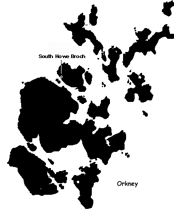
Journey to South Howe Broch
South Howe Broch is located off the B9064 on the west coast of the Island of Rousay (near the Midhowe Cairn and Midhowe Broch), which is accessible by ferry from Tingwall on the West Mainland of Orkney.
Ordnance Survey Map (HY37273037)
Visitors Information
Visitors information for Rousay may be found on the Discover Rousay website. General tourist information for Orkney may be found on the Visit Orkney website.
Additional Photos of South Howe Broch
Approaching the South Howe Broch from Land
Approaching the South Howe Broch from the Shore
South Howe Broch from the Shore
Close-Up of Part of the South Howe Broch
Close-Up of Part of the South Howe Broch
South Howe Broch
|