 Poulawack Rath and Souterrain are located approximately 650 feet from the Poulawack Cairn. While the outline of the rath is difficult to ascertain, the souterrain and its multiple openings are clearly visible.
Souterrain is a name given by archaeologists to a type of underground structure associated mainly with the Atlantic Iron Age. Underground galleries, souterrains are associated with a settlement. The galleries were dug out and then lined with stone slabs or wood before being reburied. They do not appear to have been used for burial or ritual purposes, and it has been suggested that they were food stores or hiding places during times of strife. In Ireland, they are often found inside or in close proximity to a ringfort
About Poulawack Rath and Souterrain
Poulawack Rath and Souterrain are located approximately 650 feet from the Poulawack Cairn. While the outline of the rath is difficult to ascertain, the souterrain and its multiple openings are clearly visible.
Souterrain is a name given by archaeologists to a type of underground structure associated mainly with the Atlantic Iron Age. Underground galleries, souterrains are associated with a settlement. The galleries were dug out and then lined with stone slabs or wood before being reburied. They do not appear to have been used for burial or ritual purposes, and it has been suggested that they were food stores or hiding places during times of strife. In Ireland, they are often found inside or in close proximity to a ringfort
About Poulawack Rath and Souterrain
Megalithic Ireland: Poulawack Cairn and Souterrain
The Modern Antiquarian: Poulawack Souterrain
Wikipedia: Souterrain
Megalithic Portal: Poulawack Cairn
Wikipedia: The Burren
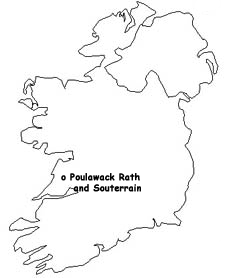
Journey to Poulawack Rath and Souterrain
Poulawack Rath and Souterrain is located near Poulawack Cairn in the Burren on a side road west of the R480 south of Caherconnell Stone Fort on the Leamaneh-Ballyvaughan road in County Clare, Ireland.
Map Reference: R234987
Visitors Information
Visitors information for the area around Poulawack Rath and Souterrain may be found at the geograph.ie website. General tourist information may be found at the Visit the Burren website.
Additional Photos of Poulawack Rath and Souterrain
Poulawack Rath
Poulawack Souterrain
Close-Up of Poulawack Souterrain
Another View of Poulawack Souterrain
Interior of Poulawack Souterrain
Poulawack Souterrain
Poulawack Souterrain
|

