 On Carraig Aille Hill (also spelled Carraig Aile) east of Lough Gur are two ring forts that have been dated from the 8th-11th Centuries. Upon excavation, dwellings were found both within and out of the ring forts, and Bronze Age, Iron Age, and Stone Age tools were also discovered, along with jewelry and bone implements.
Carraig Aille I is on the north side of the hill with its entrance looking toward the east. Carraig Aille II is located 150 feet away to the southeast. Its entrance also looks east.
About Carraig Aille On Carraig Aille Hill (also spelled Carraig Aile) east of Lough Gur are two ring forts that have been dated from the 8th-11th Centuries. Upon excavation, dwellings were found both within and out of the ring forts, and Bronze Age, Iron Age, and Stone Age tools were also discovered, along with jewelry and bone implements.
Carraig Aille I is on the north side of the hill with its entrance looking toward the east. Carraig Aille II is located 150 feet away to the southeast. Its entrance also looks east.
About Carraig Aille
Megalithic Portal: Carraig Aille
Modern Antiquarian: Carraig Aille
Wikipedia: Lough Gur
Journey to Carraig Aille
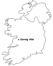
Carraig Aille is located near Lough Gur off either the R512 at Holycross or the R514 just before its intersection with R513 in County Limerick, Ireland.
Map Reference: R653408
Visitors Information
Visitors information for the area may be found at the geograph.ie website. General tourist information may be found at the Visit Limerick.ie website.
Additional Photos of Carraig Aille
Road Sign for Carraig Aille Enclosures
Entrance to Carraig Aille I
Part of the Oval Enclosure of Carraig Aille I
Another View of the Oval Enclosure of Carraig Aille I
Another View of the Oval Enclosure of Carraig Aille I
Part of Outer Wall Carraig Aille I
Part of Outer Wall Carraig Aille I
Entrance to Carraig Aille II
Part of Oval Enclosure of Carraig Aille II
Part of Oval Enclosure of Carraig Aille II
Carraig Aille II Exit from Inside Enclosure
|

