 Ardestie Souterrain was discovered in the 1940s and was excavated in 1949-1950 by F.T. Wainwright, who first suggested that the function of the souterrain was as an underground cow byre, although grain storage and ritual use have also been suggested.
The site is approximately 80 feet long and is thought to date from the 1st and 2nd Centuries A.D. Four hut sites were located around the souterrain with one hut having direct access to the chamber. One of the stones used in the construction of the souterrain has cup and ring marks that are thought to date from the Neolithic/Bronze Age, having been reused from a previous site.
About Ardestie Souterrain Ardestie Souterrain was discovered in the 1940s and was excavated in 1949-1950 by F.T. Wainwright, who first suggested that the function of the souterrain was as an underground cow byre, although grain storage and ritual use have also been suggested.
The site is approximately 80 feet long and is thought to date from the 1st and 2nd Centuries A.D. Four hut sites were located around the souterrain with one hut having direct access to the chamber. One of the stones used in the construction of the souterrain has cup and ring marks that are thought to date from the Neolithic/Bronze Age, having been reused from a previous site.
About Ardestie Souterrain
Megalithic Portal: Ardestie Souterrain
Modern Antiquarian: Ardestie Souterrain
Wikipedia: Carlungie and Ardestie Earthhouses
Wikipedia: Souterrain
Journey to Ardestie Souterrain
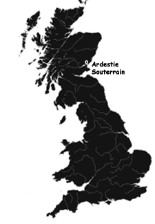
Ardestie Souterrain is located off the A92 between Dundee and Arbroath in Angus, Scotland.
Ordnance Survey Map (NO5019434441)
Visitors Information
Visitors information for Ardestie Souterrain may be found at the Historic Scotland website. General tourist information may be found at the Dundee and Angus Tourism website.
Additional Photos of Ardestie Souterrain
Path to the Ardestie Souterrain from the Roadway
Descriptive Sign at Ardestie Souterrain Site
A Look into the Excavated Ardestie Souterrain
Entrance to Ardestie Souterrain
One of Four Huts at the Ardestie Souterrain Site
Entrance to One of Four Huts at the Ardestie Souterrain Site
One of Four Huts at the Ardestie Souterrain Site
Remains of a Shellfish Tank at the Ardestie Souterrain Site
|

